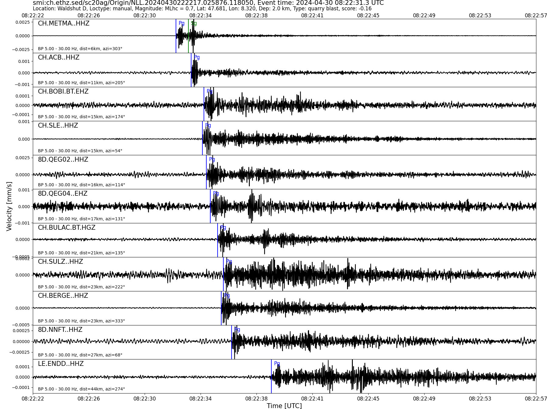
| Local time | 2024-04-30 10:22:31 |
|---|---|
| UTC Time | 2024-04-30 08:22:31 |
| Event Type | quarry blast |
| Latitude / Longitude | 47.68 / 8.32 |
| Swiss Coordinates | 666213 / 281557 |
| Magnitude | 0.7 |
| Magnitude Type | MLhc |
| Location | Waldshut D |
| Depth [km] | - |
| Location Type | manual |
| Agency | SED |
| Last Update | 30-04-2024 22:22:20 |
| Danger level | 0 (as defined by federal agencies with responsibility for natural hazards) |
| Origin ID & Metadata | smi:ch.ethz.sed/sc20ag/Origin/NLL.20240430222217.025876.118050 |
|
GSE 2.1 provisional format |
|---|
| BEGIN GSE2.1 MSG_TYPE DATA MSG_ID 2024/04/30_082553598 CHE_NDC DATA_TYPE BULLETIN GSE2.1:short Reviewed Event Bulletin (REB) of the CHE_NDC for April 30, 2024, 08:22:31.144 EVENT 2024/04/30_082231144 WALDSHUT D Date Time Err RMS Latitude Longitude Smaj Smin Az Depth Err Ndef Nsta Gap mdist Mdist Qual Author OrigID 2024/04/30 08:22:31.14 0.05 47.6861 8.3113 60481.3 6942.0 151 3.2 15.0 9 9 102 0.05 1.26 a i uk SED -------- Magnitude Err Nsta Author OrigID MLhc 1.0 0.2 7 SED -------- Sta Dist EvAz Phase Time TRes Azim AzRes Slow SRes Def SNR Amp Per Qual Magnitude ArrID METMA 0.05 303.6 P 08:22:32.425 0.0 ___ 169.0 a__ MLhc 1.0 -------- ACB 0.11 201.6 P 08:22:33.495 0.0 ___ 328.9 a__ MLhc 1.1 -------- BOBI 0.14 172.6 P 08:22:34.400 0.2 ___ 39.8 a__ MLhc 1.0 -------- SLE 0.15 57.0 P 08:22:34.275 0.0 ___ 87.8 a__ MLhc 0.9 -------- QEG02 0.15 115.1 P 08:22:34.585 0.0 ___ 184.8 a__ MLhc 0.9 -------- BULAC 0.20 135.8 P 08:22:35.334 -0.1 ___ 118.5 a__ MLhc 1.3 -------- BERGE 0.21 334.7 P 08:22:35.590 0.0 ___ 49.3 a__ MLhc 1.1 -------- NALPS 1.13 165.1 P 08:22:47.785 -5.5 ___ a__ -------- FIESA 1.26 186.8 P 08:22:45.050 -10.3 ___ a__ -------- STOP |